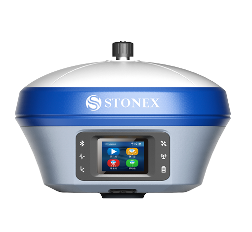
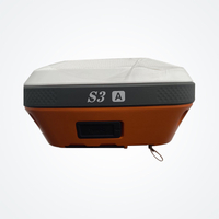
The upgraded S3a intelligent inertial navigation RTK is equipped with the popular inertial navigation inclination measurement technology, so that the measurement users can keep up with the technical trend and significantly improve the engineering lofting efficiency; the full-scale high-precision positioning board ensures the signal receiving quality and fully supports beidou-3; the IP68 protection level can withstand the wind and rain on the construction site, and can be used for a longer time. Surpad 4.0 professional survey software is close to the needs of users and provides a variety of lofting tools to easily handle the common scenes involved in engineering survey.
S3a intelligent inertial navigation RTK has comprehensive functions, stable performance and reliable quality. The professional measurement software surpad 4.0 can meet the needs of various lofting operations, such as road construction, power line survey, site leveling control, CAD application, railway lofting, etc.
Inertial navigation tilt measurement
Free from electromagnetic interference, no need for bubble alignment, measuring immediately with the pole, walking lofting,
Operation efficiency increased by 50%.
Channel, bank, river survey area, shelter, easy measurement;
Building intensive area, room corner point, easy measurement;
Municipal area measurement, not around, easy measurement;
Topographic mapping, no bubble, easy measurement.
Star searching
Based on the full-scale high-precision board card of "tianqin" generation II, facing the future satellite ground integration high-precision positioning technology, 800 channels fully support beidou-3, full constellation full frequency point signal tracking, and fast locking satellite signal.
Good signal
The built-in "Swan" anti-interference technology can actively detect and effectively suppress the internal and external interference signals, meet the measurement requirements of complex environment, and effectively fix the solution.
Long endurance
Built in dual intelligent lithium battery, to meet the daily needs of 10 hours. Type-C interface supports fast charging of PD and shortens charging time. When the power is in emergency, use the power bank to supply power to ensure the power supply and ensure the battery life.
Radio cattle
The second generation of global communication radio, transceiver integration, 410-470mhz full frequency. Channel detection actively identifies interference; 7 + 2400 channels are set on demand to avoid cross frequency. Real realization and mainstream brand RTK radio protocol interoperability, full compatibility.
Strong protection
IP68 military grade protection, to resist dust invasion, to avoid damage to components; even if immersed in water for a long time, it can also provide comprehensive protection.
Continuous measurement
The standard configuration of satellite link can continue to maintain centimeter precision operation when the ground conventional data link is disconnected, so as to avoid delay of construction period.